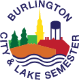

Each year, a Place-Based Learning Teaching Fellow brings their unique passions and gifts to the BCL team. This year, among many other assets, Cate MacDonald, a UVM Geography major, brings her love of maps.
I’ve always been someone who wants to visualize and make tangible the systems that make up the world we live in. And as my world view expands, that only gets harder. Maps are a tool that can help. Much like how artists depict abstract concepts, making them relatable and engaging to a wide audience, mapmakers aim to boil complex ideas into digestible formats. They are the overseers, the wide angle lens, the big-picture thinkers of the complex systems we operate within. To clarify, when I say systems, I am referring to any network of things that operate as a whole. Examples include city streets, mountain ranges, watersheds, neighborhoods, the trans-national food system, etc. Visualizing networks like these on a map can help people better understand their place within them. Maps can help people feel more connected to the larger “system” that these networks make up, and in turn, not just be passive participants of it, but active, autonomous agents within it.
Thanks to my Geography degree and Certificate in Place-based Education from UVM, I feel more connected to Burlington than I’ve felt to any other place in my life. This connection seeps into how I interact with new places. Like a map, it has helped me make sense of unfamiliar environments, and visualize my place in them, both physically and as an actor in their systems, even if just for a day.
Exploring maps with the BCL15 students gets me excited for their learning, understanding, and curiosity about not only Burlington, but the broader world. I am hopeful for these students’ ability to understand complex global systems, to form connections between how Burlington operates and how larger cities function–all because they know what it’s like to zoom out, hover from above, and view the interconnected networks that make up their community.
- Cate MacDonald
Activities that ask us to map out what is important to us make me feel much more connected to this place. Everyone lives in a slightly different Burlington, places that I know so well are completely foreign to others and vice versa. Seeing my peers’ perspective on Burlington gives me a fuller understanding of the place where I live.
- Cal
For me, exploring maps has been very fun. I thoroughly enjoyed looking at the historical maps, and getting a better idea of what Burlington looked like years ago. I also have enjoyed looking at more modern maps, and using my knowledge of the city while looking at the maps.
- Jesse


I’ve never really spent my time looking at a map. At first it was a little challenging to decipher what I was looking for on a map. Like the Burlington maps. I live in Burlington, but didn’t have a clue where anything was. We’ve done a lot more scoping out maps, so it’s sort of familiar now. When the class went out to the Sailing Center to check out Burlington’s history through maps, I struggled the most. I had no idea what I was really looking for. After a while I could see how much Burlington has changed over the years.
- Taeshon
I learned a lot about the history of Burlington during the map activity we did in the Sailing Center. I had no idea how much of the waterfront was filled. I knew Vermont was a big part of the lumber industry, but even still, looking at the pictures of all the wood was surprising. Looking at all these maps definitely taught me more about the town I grew up in. It was cool to learn new stuff, and it made me feel a deeper connection to this place.
- Jamo
It has been a great experience to work with so many different maps. I think in this digital age, I often forget the importance of seeing things on a broader scale. Using maps in our activities has helped me to “zoom out” and look at Burlington from a bird’s eye view. The different ways we have used maps, and the variation of the maps we’ve used, has provided many different perspectives, furthering my learning and point of view.
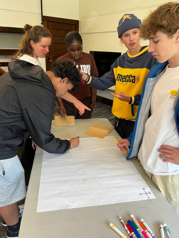
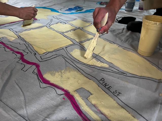
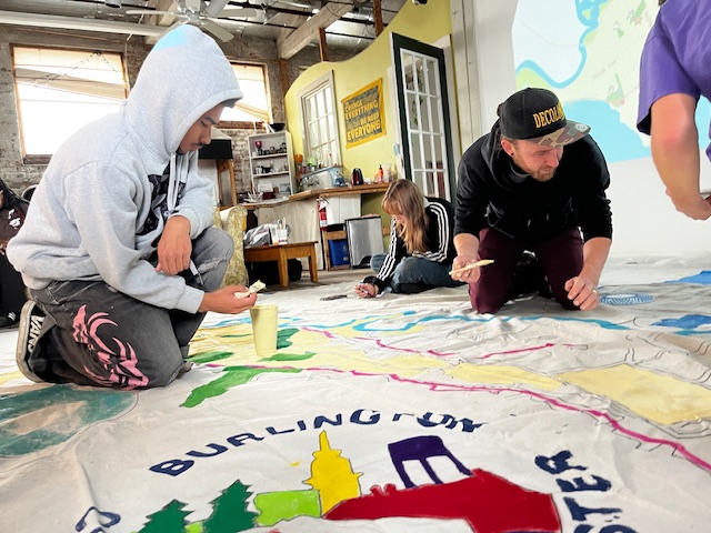
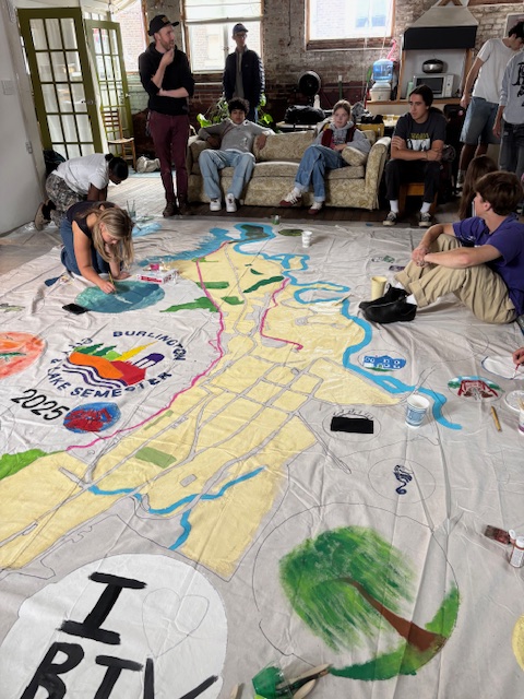
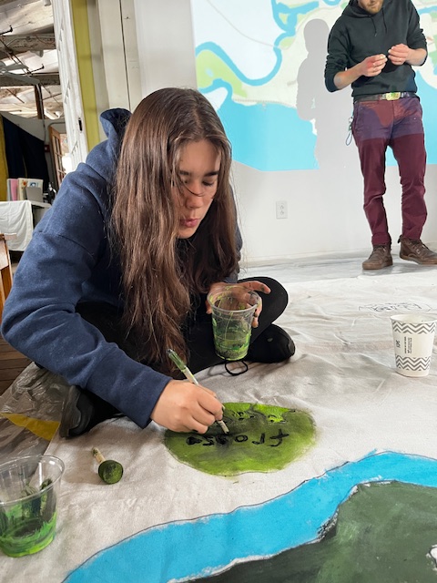
My favorite map-related activity so far has been when we painted our large-scale map with Kristian. I love art and painting, and it was so cool to have a mix of a group map and our own personal bubbles. It was fun to trace and color in the map, and I loved seeing what everyone created. This changed my understanding because tracing the lines helped me to visualize the lines of Burlington and where each thing was. It also helped me to appreciate how many parks we have, and all the natural space.
- Harper
I really enjoyed making the banner map, because it was creative…and also a lot more personal and connected to one another. It made me realize that everybody will always have a different experience, no matter what we’re doing. This kinda made me less nervous, because everyone was just as nervous. Personally, I have started to realize how many people live right next to me and how I would’ve never known if it wasn’t for BCL. And I can’t wait to be able to learn more about myself and the community I live in.
- John
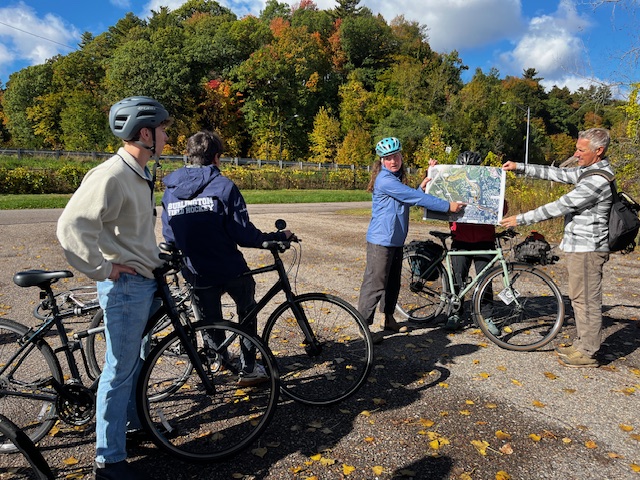
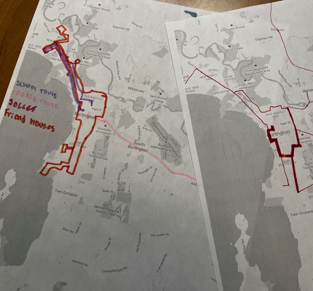
Looking at the GMT route map of Burlington really showed me how difficult it is to build an effective transit system for our area. Burlington has three distinct areas that are separate and the map showed me the struggles of connecting them. You can have a North Ave bus, but what happens when people want to get to their house and they live far off the ave? The map also showed me how the natural circular nature of most cities doesn’t exist in Burlington because of the lake.
- Sam
Working so much with maps has been challenging for me, because I’m not good with maps 😦 But it’s been really interesting to see how things are built. The most interesting activity was the one when we looked at maps for cars. I didn’t know that there weren’t a lot of places where you couldn’t walk or bike safely.
- Jasmine
So far my experience with maps has been good. Spending time with maps has helped me see data better with how things happen over time with how it affects the maps in a good or positive way. It was interesting to learn about the bike paths and roads, because we got to show how we can make the roads better or more suitable for bikers and cars.
- Taelor
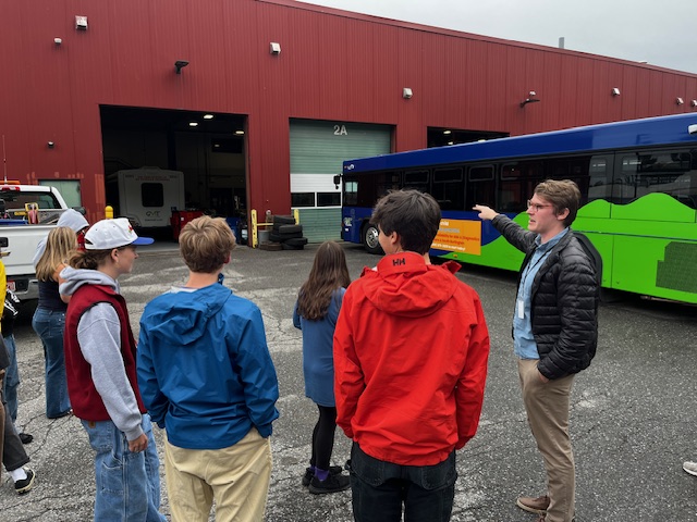

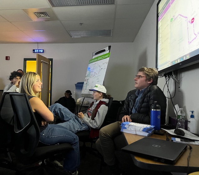
The GMT mapping was an eye-opening experience– learning about what it cost to maintain bus routes for the public, [while also] making it accessible to the city. This activity reminded me that everyone faces daily challenges, and constructs their lives around what’s available for them. This made me think about being more aware of my accessibility in my life.
- Emanuel
I enjoyed the map activity at GMT. It was really interesting to reflect on where I go everyday. I didn’t realize how many times a day I go up and down North Ave….The [mapping] activity helped me get interested and engaged with the system. It was cool to hear about the route/cost ratio and map those out ourselves.
- Vera
When we first looked at maps I didn’t really know a lot about Burlington. But now that we look at them a lot more often, I feel like I know more about Burlington. We also used maps to make changes in Burlington, like changes to the bus routes and when we used maps to [show] what we wanted to add to our community. I like having a say about what we should do with our community, because we’re going to live in it.
- Anzal
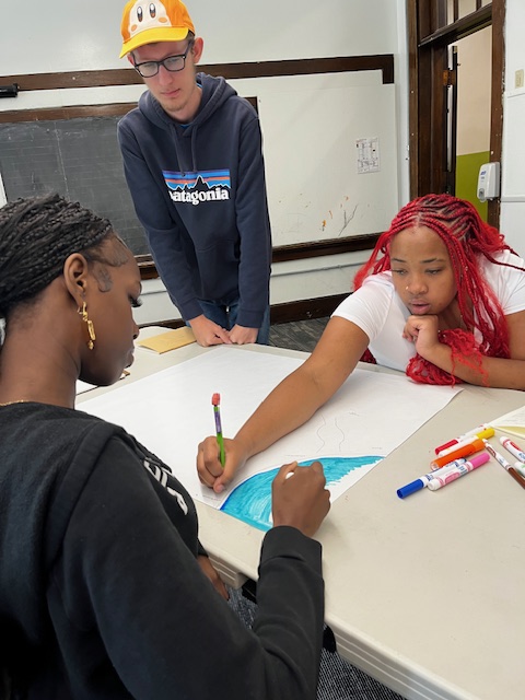
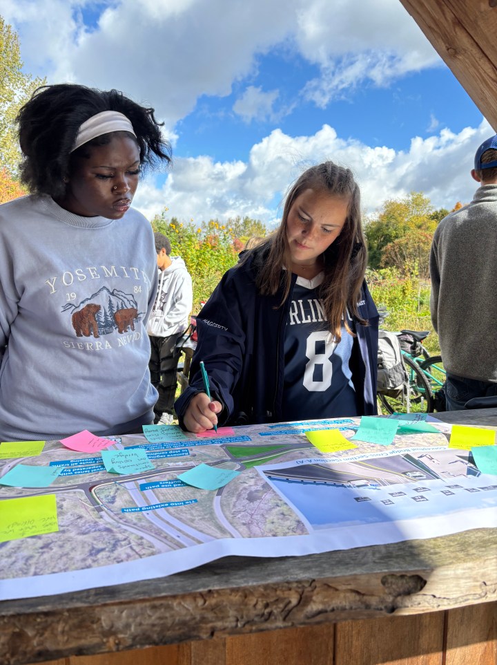
I really enjoyed working with Sarah, from City Planning, to map neighborhood “assets” (qualities) — AND to design new elements for Burlington’s future. I thought this was very interesting as we broke off into our separate neighborhoods and it made me feel more connected. Not only was it cool hearing what other people had to say but I also shared my opinions on what should change and what should be added. It was probably my favorite mapping exercise yet.
- Eamon
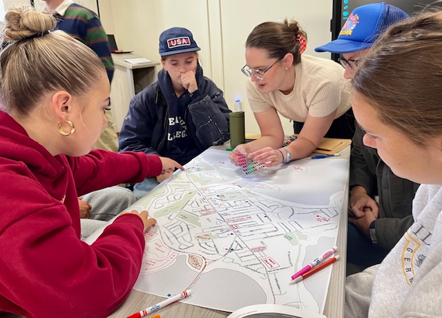
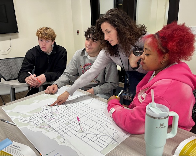
I liked the most recent activity with maps that we got to do at City Hall. We got to be in groups of people who had known each place well, so we all had similar perspectives on the things we wanted. Not only was it fun because we got to be creative, but I also learned that even though we were adding things as jokes, each of those things symbolized a value that we are missing in our part of Burlington. For example, we had added more food places as well as more social places. These are things that the New North end is lacking. Even though we added those things as a joke, [it’s also true that] we could definitely benefit from having more social places and food places.
- Lucy
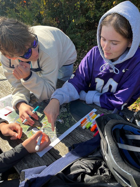
When we were split into groups based on the neighborhood, I was really surprised. I had never thought about the fact that when people think about change and improvements, they think about the big picture when it comes to Burlington. But during this activity, I realized that everywhere in Burlington has its own needs that are unique to it and must be tackled in a way to not disrupt the preexisting flow of the area.
- Skylar
Spending time with maps from multiple different perspectives has been interesting. I like taking it from a city, art, bus, and historical perspective. These are all aspects of Burlington I am familiar with, but they all seem wildly different. How can a drawing of my favorite coffee shop interact with the big-time work of city planners? Exploring the city through one medium but with different lenses was a great way to expand my view on Burlington.
- Miranda
